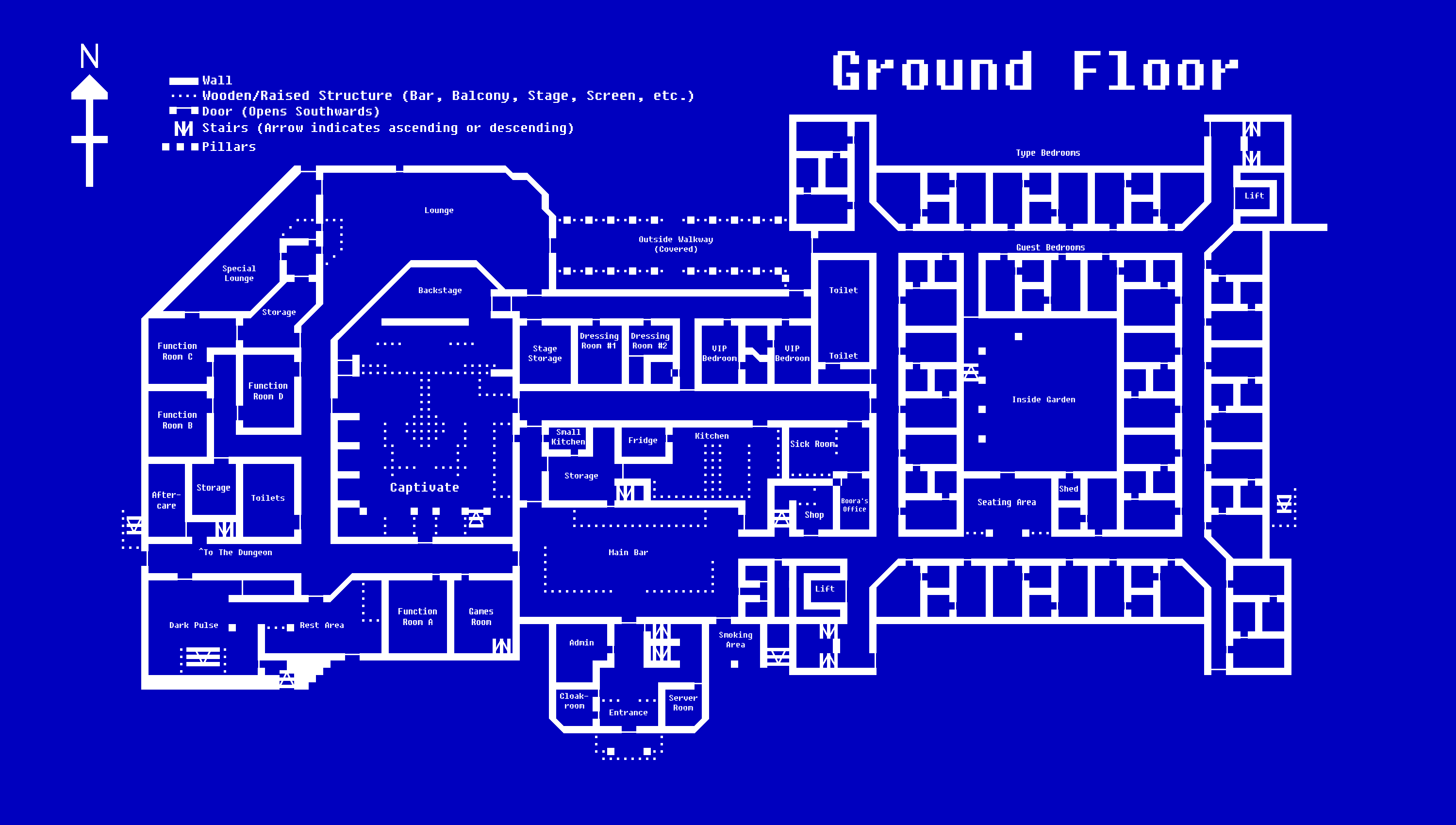
File:Plaisir Ground Floor Map.png
Revision as of 23:00, 15 April 2020 by Wrincewind (talk | contribs) (a map of the café's ground floor locations)
Size of this preview: 800 × 453 pixels. Other resolutions: 320 × 181 pixels | 3,000 × 1,700 pixels.
Original file (3,000 × 1,700 pixels, file size: 68 KB, MIME type: image/png)
Summary
a map of the café's ground floor locations
Licencing
{{subst:Permission from license selector}}
File history
Click on a date/time to view the file as it appeared at that time.
| Date/Time | Thumbnail | Dimensions | User | Comment | |
|---|---|---|---|---|---|
| current | 23:00, 15 April 2020 | | 3,000 × 1,700 (68 KB) | Wrincewind (talk | contribs) | a map of the café's ground floor locations |
You cannot overwrite this file.
File usage
The following page links to this file: